-1.png?width=5230&height=1198&name=unnamed%20(4)-1.png "Wayne Stiles")


We live in an age in which traveling great distances no longer proves a challenge. Modern transportation requires little more than a basic understanding of road signs and airline gates (which somehow I still seem to miss).
Consequently, we feel little need to know much about geography. And yet, geography played a critical role in ancient Israel.
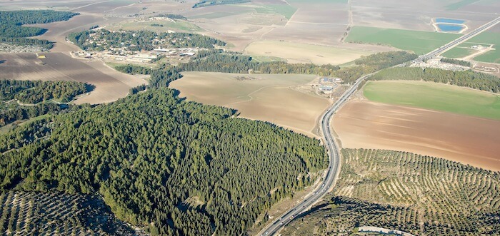
(Photo: The modern highway still follows the Megiddo Pass. Courtesy of the Pictorial Library of Bible Lands)
God placed the land of Israel in a position as the only intercontinental land bridge between the superpowers of the ancient world. The strategic International Highway, sometimes called the Great Trunk Road or the Via Maris (“Way of the Sea”), ran from the Fertile Crescent all the way to Egypt—the full length of the land of Israel.
For us today, a good stick of dynamite takes care of the traveling problems that challenged those who journeyed through Israel.
No place illustrates this better than Mount Carmel.
God Uses Even Highways
Israel stood at the crossroads of three continents—Asia, Africa, and Europe—and the surrounding seas and deserts forced all who traveled to Egypt by land to traverse Israel.
- Thus, the armies of Egypt, Assyria, Babylon, Media-Persia, Greece, and Rome all invaded Israel in order to control its International Highway.
- Even today, Israel serves as the overland passageway for large, high-flying birds that prefer not to migrate over the seas. Literally hundreds of thousands of black and white storks, steppe and spotted eagles, black kites, steppe and honey buzzards, and Levant sparrowhawks soar over the Holy Land in their biannual migrations to and from east Africa. It’s no wonder bird watching remains a popular activity in Israel.
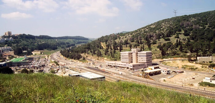
(Photo: The Jokneam Pass in Mount Carmel from Jokneam. Courtesy of the Pictorial Library of Bible Lands)
Mount Carmel and Its Three Passes
As the highway ran north from Egypt, the road forked three ways in order to traverse the imposing Mount Carmel range. History illustrates how each of these passes was used.
Jokneam Pass
First, to the west, the highway followed the Jokneam Pass (modern Route 70) through Mount Carmel. When traveling through this pass today, I think of Napoleon who used this ancient road in AD 1799 on his journey north to Acre.
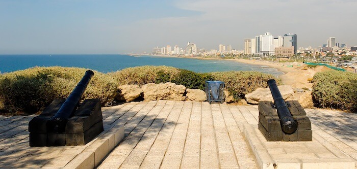
(Photo: Napoleon’s cannons at Tel Joppa. Courtesy of the Pictorial Library of Bible Lands)
Second, the central pass through Mount Carmel served as the most significant fork of the International Highway.
Megiddo Pass
Whenever I travel on the Megiddo Pass (modern Route 65), I try to imagine the chariots of Pharaoh Thutmose III (1504-1450 BC) as they rumbled north to battle the Canaanites at Megiddo. (Thutmose III was the Pharaoh who oppressed the enslaved Hebrews; see Exodus 2:23.)
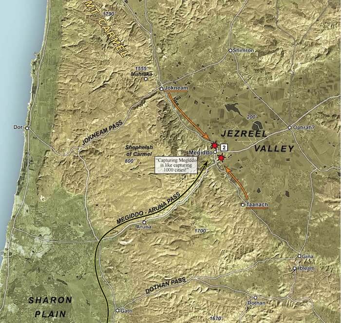
(Map: Thutmose III at Mount Carmel, courtesy of Satellite Bible Atlas)
The map above shows the events of Thutmose III and his conquering Megiddo.
- Approaching Mount Carmel, Thutmose III and his council deliberated on which route to take. Scouts showed Canaanite forces at Jokneam and Taanach, but none guarding the narrow Megiddo pass.
- Thutmose III chose the Megiddo pass—the most unlikely and difficult route—and surprised the Canaanites who had to rush back to Megiddo to defend the city—which they ultimately lost.
Dothan Pass
Finally, the Dothan Pass served as the eastern fork of the International Highway through Mount Carmel. Driving through this beautiful pass today (approximately Route 585), I imagine Joseph whose brothers sold him to a caravan of Ishmaelites who were traveling the International Highway south to Egypt (Genesis 37:17-28).
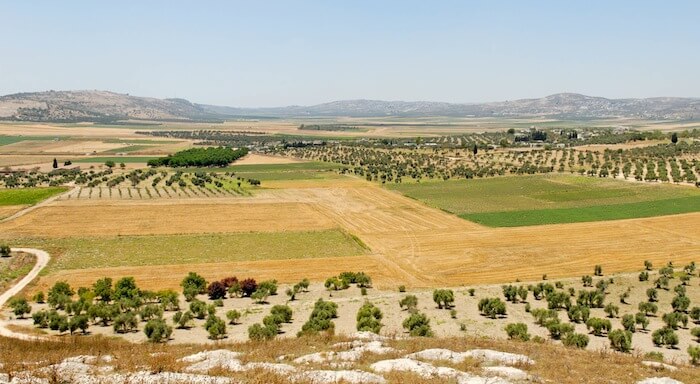
(Photo: The Dothan Valley. Courtesy of the Pictorial Library of Bible Lands)
Interstate Influence
I find it fascinating that when world powers traveled through Israel during biblical days, God’s people would either influence them or be influenced by them. Because of this influence, Israel’s central position among the nations proved to be a double-edged sword.
A blog post hardly does justice to the significance of Israel’s International Highway.
Today, only historians, Bible students, and migrating birds tell the story.
Want To Tour The Bible Lands From Wherever You Are?
Embark on an immersive, online journey through the sites of the Bible with Wayne Stiles and Walking the Bible Lands. Click below to learn more:

Tell me what you think: The Pharaoh chose the most difficult route and it paid off. How do you choose which way to go? To leave a comment, just click here.
Click here to leave a comment.
.jpg?width=350&name=Wayne-books-350wide%20(1).jpg)