East of the Sea of Galilee, a long plateau rises above the surrounding basins. For thousands of years, the Golan Heights in Israel has remained the envy of its environs—even to today.
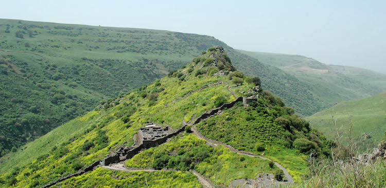
(Photo: Gamla. Courtesy of the Pictorial Library of Bible Lands)
Those who drive along the eastern side of the Sea of Galilee and its ridge on the Golan seldom see 3 sites with odd names and curious histories.
Here’s a hint at their names:
- Camel back
- Circles in circles
- Port Harp
Can you guess?
Gamla Nature Preserve
The site’s name means “camel,” likely because its rocky promontory resembles camel humps.
The site has many hiking trails and picturesque cliffs, affording visitors views of the largest colony of Griffon vultures in Israel. This video shows the vultures as well as other animals in the nature reserve.
Gamla’s steep cliffs provided an effective defense in times of siege.
- During the Jewish Revolt in AD 66, the occupants courageously defended Gamla.
- For this reason, some have called Gamla, “Masada of the North.”
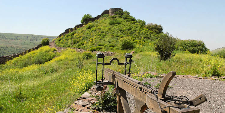
(Photo: Gamla with a reconstructed Roman catapult. Courtesy of the Pictorial Library of Bible Lands)
Gamla would have been one of the “surrounding villages” to which the crowds would have had to go in order to find food, had Jesus not provided through the miracle of the fish and loaves (Luke 9:10-12).
On the way to the Gamla Waterfall (Israel’s highest at 164 feet), you can see one of the Golan Heights’ many dolmens—large, aboveground burial chambers that predate Abraham.
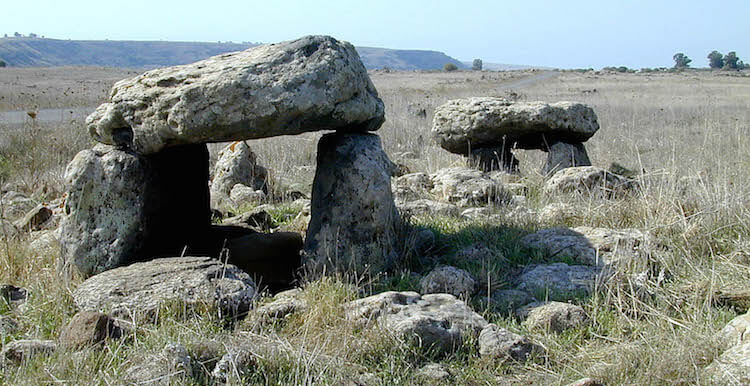
(Photo: Dolmen near Gamla. Courtesy of the Pictorial Library of Bible Lands)
Rogem Hiri
Across the highway from Gamla, this mysterious site dates no earlier than 1500-1200 BC. Rogem Hiri also bears the Arabic name, Rujm al-Hiri, meaning, “stone heap of the wild cat.”
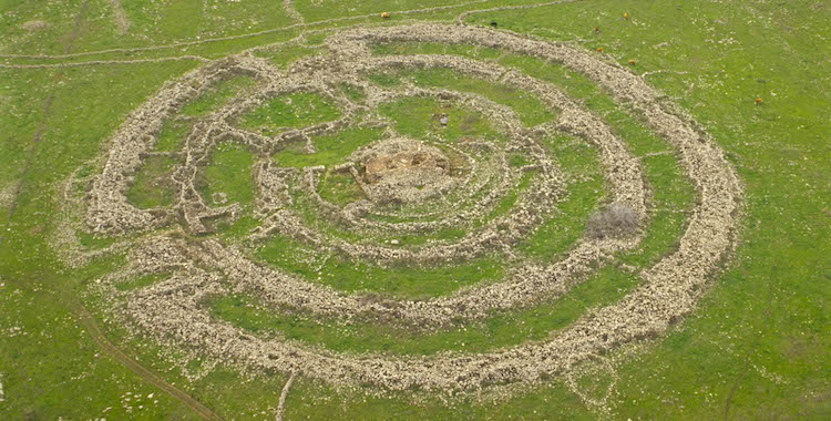
(Photo: Rogem Hiri aerial. Courtesy of the Pictorial Library of Bible Lands)
Looking like a stage set from some science-fiction film, these ancient heaps of stones of Rogem Hiri form four massive concentric circles around a central cairn; the diameter of the largest circle measures 490 feet.
- The central pile of stones, or cairn, measures 82 feet in diameter and covers a burial chamber topped by two immense basalt slabs.
- The crumbling walls of Rogem Hiri are up to eleven feet wide and eight feet high.
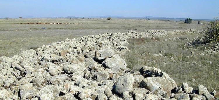
(Photo: Rogem Hiri outer circle. Courtesy of the Pictorial Library of Bible Lands)
Some have suggested this mysterious arrangement of stones—whose exact purpose remains dubious—is the tomb of the giant King Og of Bashan (Deuteronomy 3:11).
Tel Hadar
The two-and-a-half acre Tel Hadar rests between En Gev and Bethsaida (et-Tell) by the Sea of Galilee and may have served as a regional port for Tel Chinnereth.
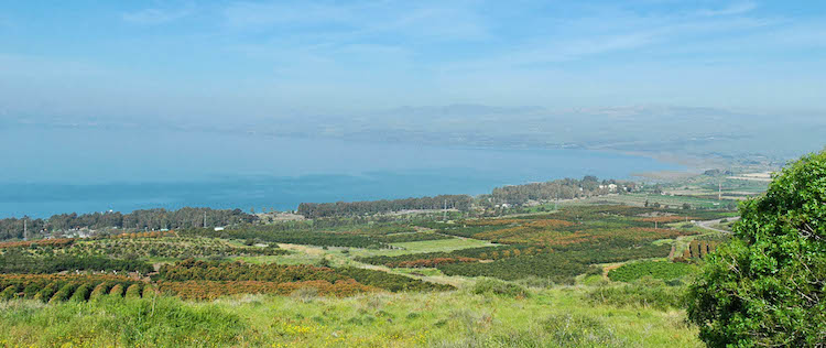
(Photo: Tel Hadar beside the Sea of Galilee. Courtesy of the Pictorial Library of Bible Lands)
If so, grain from ancient Bashan in the Golan would have made its way through Tel Hadar’s port before its destination at the Mediterranean Sea.
Wandering among Tel Hadar’s basalt remnants—typical of ruins in the Golan Heights—reveals excavations from the Late Bronze I and Iron Age I-II periods, dating from the 15th– to the 8th-centuries BC. Ruins at the site include two tripartite-pillared buildings (common among Israel’s tells), two storehouses, and a grain silo.
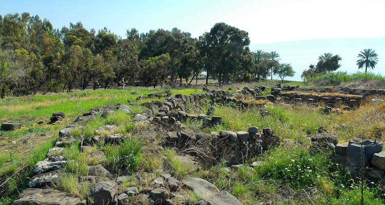
(Photo: Tel Hadar fortification wall. Courtesy of the Pictorial Library of Bible Lands)
Tell me what you think: What’s your favorite site on the east side of the Sea of Galilee? To leave a comment, just click here.
On the Map: Gamla, Rogem Hiri, and Tel Hadar
You’ll find these sites and more in a book I wrote for the Israel Ministry of Tourism, 100 Off-The-Beaten-Path Sites. You can download a free copy.