Not everybody can travel to Israel. But everyone can benefit from including Bible lands in their personal Bible study. You just need some good tools.

(Photo: Tabernacle Model. Courtesy of the Pictorial Library of Bible Lands)
I have discovered that including Bible lands in my study has given me more understanding of the Bible than I ever imagined. The benefits of including Bible lands in the study of Scripture are available to everyone.
Many people have asked what resources I recommend. So I’ve created what I consider a must-have list. These are the tools I reach for first when I study—those resources that have proven most helpful to me for years.
I’ll give you the full list, and then I’ll suggest which ones to get first.
Bible Atlases
 The most basic resource for studying Bible lands is a good Bible atlas. Good atlases provide more than maps; they teach the importance of geography as it relates to history, archaeology, topography, climate, and soils. Several outstanding atlases are available today. These are the three I use the most.
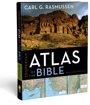
- Zondervan Atlas of the Bible, by Carl G. Rasmussen. This is a revision of Rasmussen’s excellent NIV Atlas of the Bible. This was the first atlas I seriously read and used, and its text is excellent. Dr. Rasmussen has spent many years teaching in Israel and his atlas gives you the benefit of this time. His Essential Atlas of the Bible is an abridged version that’s still very accessible.
- The Satellite Bible Atlas, by Bill Schlegel. A new Bible atlas with 85 full-page color maps. The biblical events are marked on enhanced satellite imagery, accompanied by geographical and historical commentary. Your purchase includes a link to download the outstanding digital maps, which I used to search in Evernote.
- The Sacred Bridge: Carta’s Atlas of the Biblical World, by Anson F Rainey and R. Steven Notley. I’ll be honest: this is my favorite. It’s pretty dense and scholarly, but it makes good use of original sources and languages. It’s also expensive, but I always appreciate the detail and insights it gives me every time I open it.
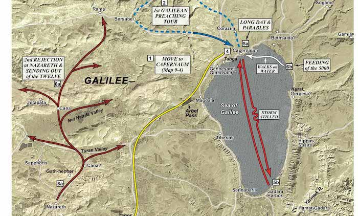
(Map of Jesus’ Public Galilean Ministry, courtesy of Satellite Bible Atlas)
Images of Bible Lands
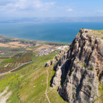
If a picture paints a thousand words, then thousands of high-resolution pictures are even better. I use the images from the Pictorial Library of Bible Lands almost daily on my blog (including the image at the top of this post!), and I have used them for years in my teaching and personal Bible study.

(Photo: The Western Wall, just one of thousands of images from the Pictorial Library of Bible Lands)
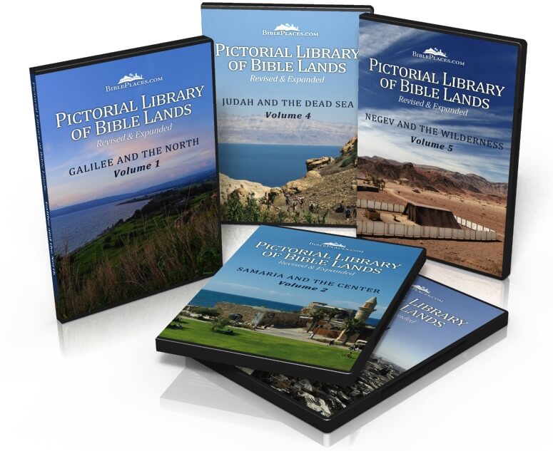
The best deal is the Israel Collection—which I use. But you could get one volume at a time. See the entire collection.
Here are the volumes related to Israel:
- Jerusalem—includes more than 1500 photos of the Old City, Temple Mount, City of David, Western Wall Tunnels, West Jerusalem, and the Mount of Olives.
- Samaria and the Center—includes more than 1200 photos of the Jezreel Valley, Harod Valley, Mount Carmel, Sharon Plain, Samaria, Jordan Rift, and Benjamin.
- Galilee and the North—includes more than 1100 photos of the Golan Heights, Huleh Basin, Galilee Hill Country, Sea of Galilee, Jordan River, and the Plain of Asher.
- Judah and the Dead Sea—includes more than 1500 photos of the Hill Country of Judah, Judean Wilderness, Dead Sea, Shephelah, and the Philistine Plain.
- Negev and the Wilderness—includes more than 700 images from the regions of the Biblical Negev, Negev Highlands, Nabatean Cities, Nahal Zin, Spice Route, Wilderness of Zin, Wilderness of Paran, Aravah, and the Red Sea.
- Israel Collection—all of the above, including more than 6000 images and 100 PowerPoint presentations.
Take a look at the Pictorial Library of Bible Lands and see why this photo collection is so unique, so valuable, and so useful.
Books about Bible Lands Geography
If you’re interested in the land itself, these books do a great job—and have for many years.
- The Land of the Bible, by Aharoni. Somewhat dated, this book still does a superb in its presentation of biblical geography. It has been a standard textbook for years in this field.
- The Historical Geography of the Holy Land, by George Adam Smith. I absolutely love this book for the rich descriptions it offers of Bible lands. Written more than a century ago (when digital cameras were scarce), Smith relied on words to paint a picture of what he saw. Very well written. (You may enjoy reading about my 1987 edition of this book when I discovered the London publisher messed up the binding.)
My Essential List
Obviously, dream list would include all of these resources! But here’s the essential list in the order I suggest you get them:
- Zondervan Atlas of the Bible, by Carl G. Rasmussen.
- The Satellite Bible Atlas, by Bill Schlegel.
- The “Israel Collection,” from the Pictorial Library of Bible Lands. You really should get the entire library eventually.
You can start here and add to this list on your birthday and at Christmas.
Tell me what you think: What other resources have you found helpful in studying Bible lands? To leave a comment, just click here.